
Key Considerations
As part of the planning process, the project team have undertaken numerous surveys of the development site in order to identify the key considerations. The sections below discuss the response to these considerations, which include Access, Drainage & Flood Risk, and Ecology.
Access Strategy
The proposed development would be accessed via the existing signal-controlled junction on the A617 Rainworth Bypass (also know as the Mansfield Ashfield Regeneration Route, or the MARR).
The existing road into the site, Rufford Colliery Lane, was constructed to serve the former colliery, and link workers to Rainworth. The road now also serves the sewage works and Cygnet healthcare facility.
Accessibility Strategy
The former colliery access road is proposed to be upgraded to provide new pedestrian and cycle facilities into the heart of the development, which in turn would connect to the existing sustainable transport infrastructure along the MARR, and south into Rainworth along the old Colliery Way.
A Transport Assessment will accompany the application, and will examine how the existing sustainable transport infrastructure can be further enhanced to improve the existing connections, and a public transport strategy will be proposed, to ensure that the development is well connected to the surrounding area for all modes of transport.
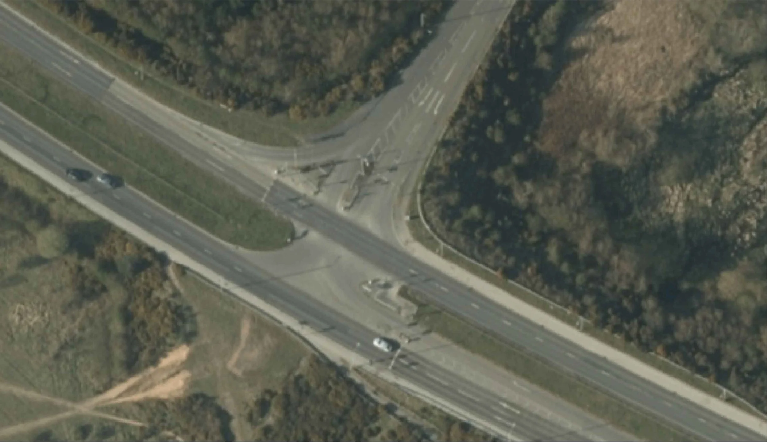
Aerial view of existing site access off A617
Drainage & Flood Risk
The proposals have been carefully designed around the areas of flood risk associated with the wider Colliery site, particularly areas of flood risk to the south-east of the site.
All structures are proposed to be located outside of the areas of highest flood risk. A full assessment of the flood risk affecting the site will be undertaken, to ensure that the proposals will not impact or exacerbate offsite flood risk.
Surface water will be managed through Sustainable Drainage Systems (SuDS) principles – ensuring that water is attenuated and drained from the site without affecting the wider area. Attenuation basins will provide drainage benefits to the site, whilst encouraging ecological improvements.
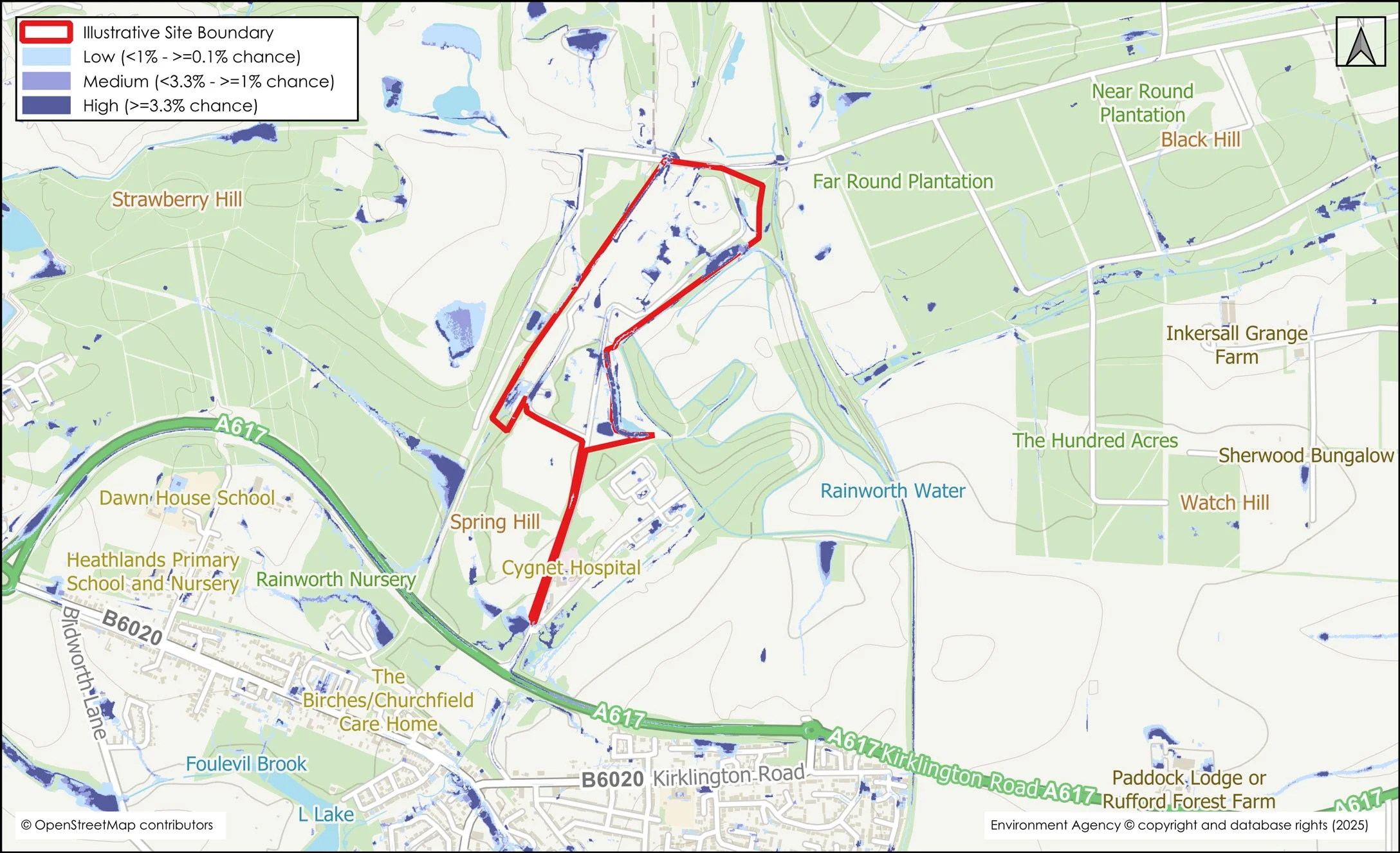
Surface Water Flood Risk Map

Flood Zone Map
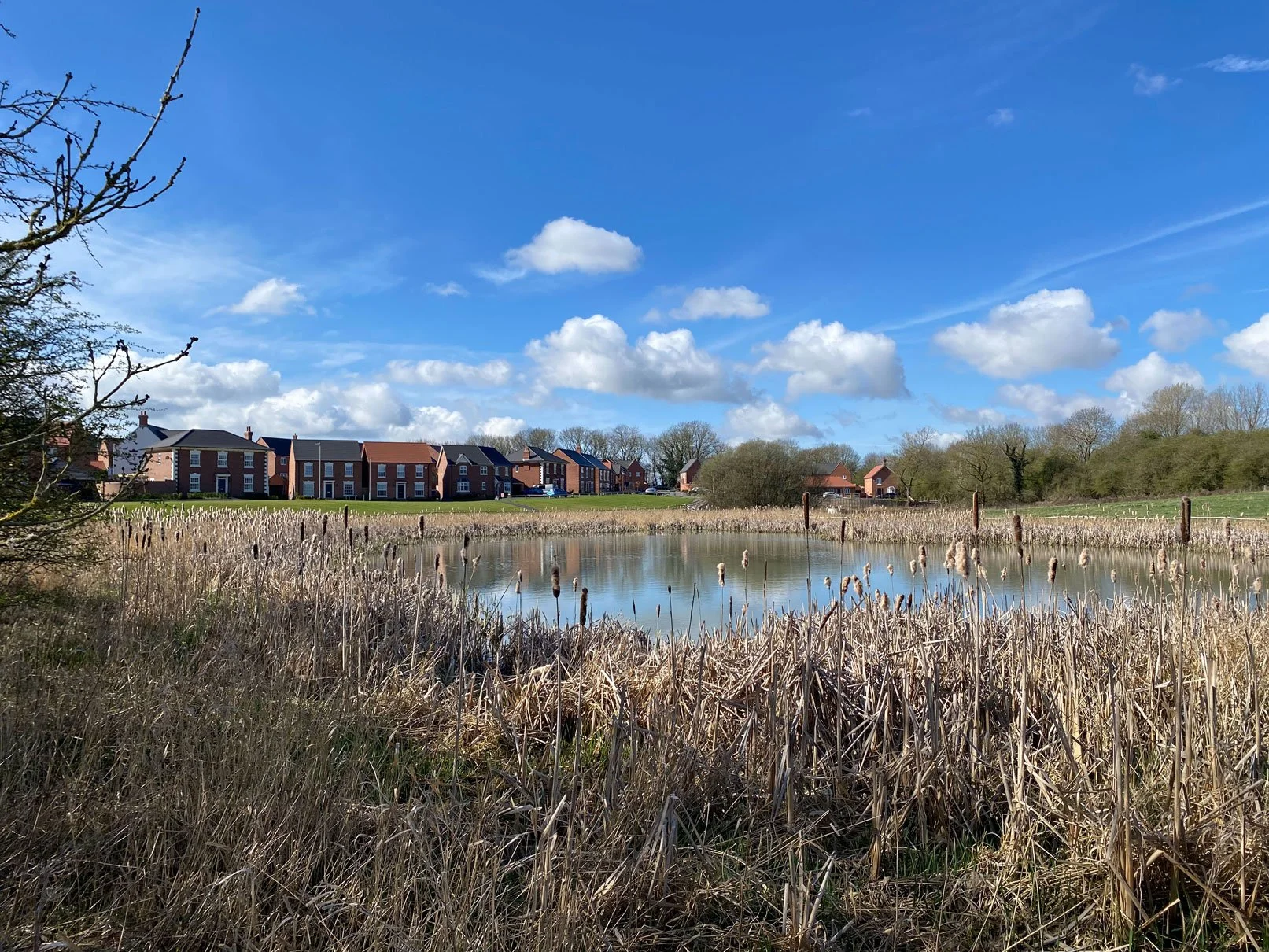
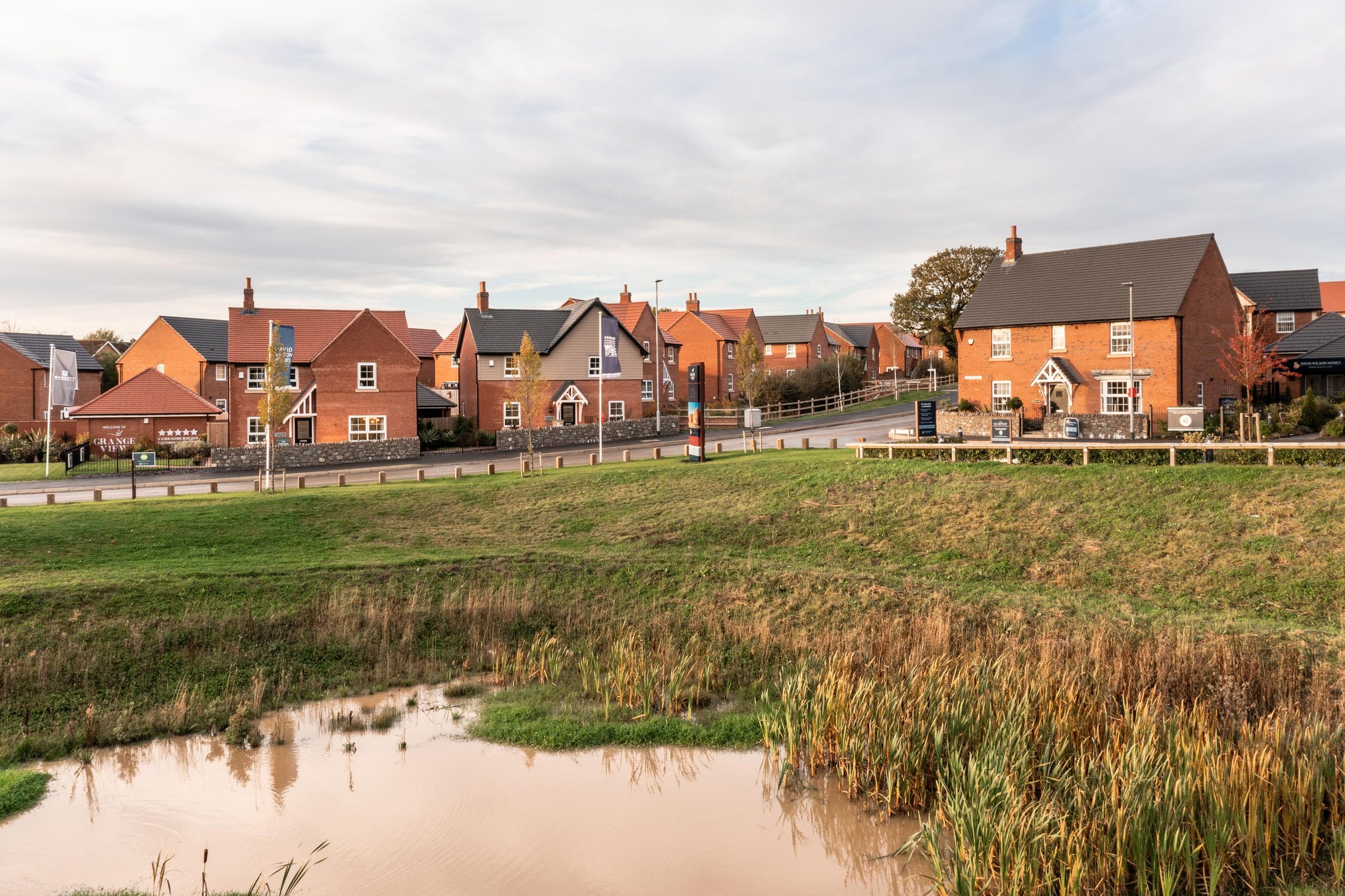

Example images of drainage basins
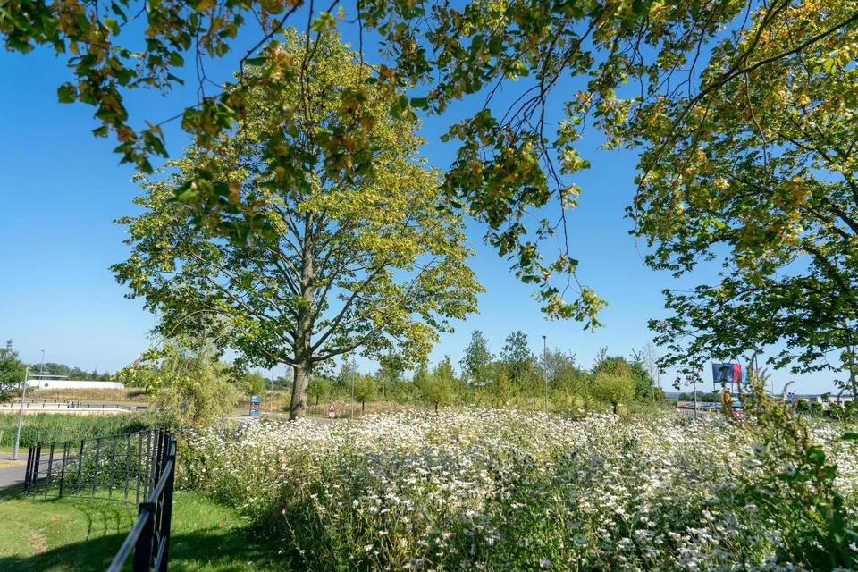
Ecology
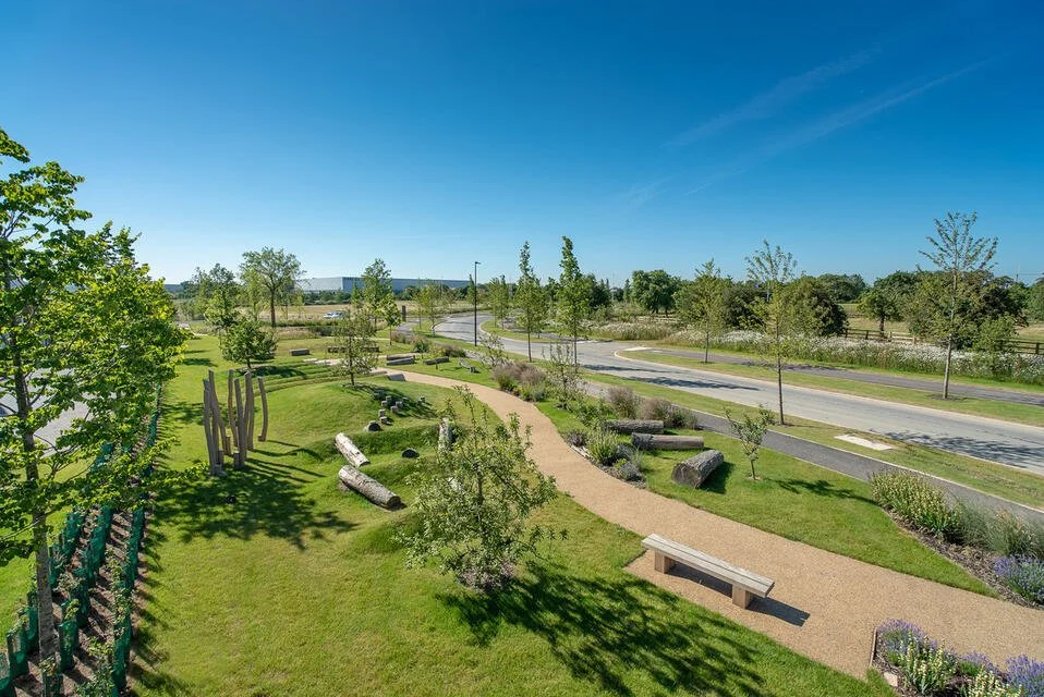
The landscape strategy for the site will look to improve the existing biodiversity on site through careful regeneration of the former pit yard, with a mix of open space types incorporated into the residential and commercial aspects of the masterplan.
The masterplan shows the areas of greenspace to be provided within the site, including creation of a village green.
To ensure the proposals align with the wider colliery site, the masterplan will seek to incorporate native tree planting, shrub and grassland planting where possible to provide residents with positive access to public open green space, including the Rainworth Water Local Nature Reserve (LNR) to the east of the site.
An Ecological Working Group has also been established which includes ecological representatives from Newark and Sherwood, Natural England, The Wildlife Trust, Nottinghamshire County Council, EMEC Ecology, and Brooks Ecological.
It is expected that a 10% biodiversity net gain can be achieved within the wider site.